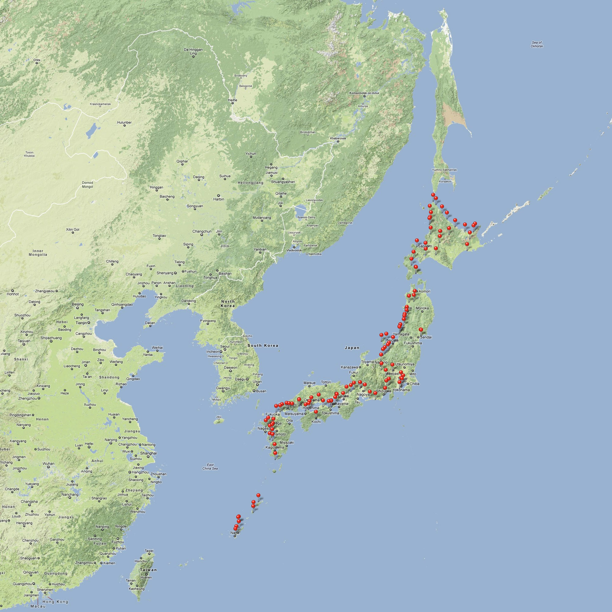
Here is the map of my cycle tour route. The red pins are from the photos I took on my phone. (Click the map to enlarge)
This post is also available in: Japanese
Here is the map of my cycle tour route. The red pins are from the photos I took on my phone. (Click the map to enlarge)
This post is also available in: Japanese
© 2024 FindingSachi – Japanese Food, Cycling Japan, Foodie Adventures | See Japanese food found on a bicycle tour
Eat, move, be happy :)


Hi Sachi,
I am from Saco, Maine and is planning a bicycle trip in May 2013 and Japan could be the first destination. This is rather a silly question, but how did you plan your route? I meant did you use map or gps? I am new at the touring scene. I really enjoy your blog, thank you.
Hi Vin,
Apologies for my delay in reply! I used my iPhone, laptop and its google map to plan day by day. I didn’t have a Garmin GPS, although I hear it’s good too. I was new to touring too, and that made it easy. After a while, I could tell how far I could go in a day, and sometimes I would want to stop short to visit interesting sites. I did also use some map books for motor cycle touring in Japan at times. It’s very detailed in route and has lots of info, but rather heavy and only in Japanese. You don’t need it.
You’ll enjoy touring Japan, especially if it’s in May. It’s the most comfortable time to cycle!